
Chenzhou topographic map
Interactive map
Click on the map to display elevation.
About this map
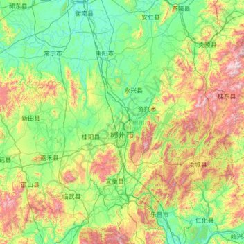
Name: Chenzhou topographic map, elevation, terrain.
Location: Chenzhou, Hunan, China (24.89368 112.22413 26.84111 114.23190)
Average elevation: 443 m
Minimum elevation: 49 m
Maximum elevation: 2,012 m
Other topographic maps
Click on a map to view its topography, its elevation and its terrain.