Geolocate

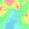
Gullfoss topographic map

Click on the map to display elevation.

About this map

Name: Gullfoss topographic map, elevation, terrain.

Location: Gullfoss, Bláskógabyggð, Southern Region, Iceland (64.30019 -20.16534 64.32894 -20.11838)

Average elevation: 214 m

Minimum elevation: 125 m

Maximum elevation: 311 m

Other topographic maps

Click on a map to view its topography, its elevation and its terrain.

Syðstasúla

Iceland > Bláskógabyggð

Average elevation: 710 m

Thingvellir

Iceland > Bláskógabyggð

Average elevation: 121 m

Gullfoss Falls

Iceland > Bláskógabyggð

Average elevation: 221 m

Strokkur

Iceland > Bláskógabyggð

Average elevation: 115 m

Geysir

Iceland > Bláskógabyggð

Average elevation: 116 m

Skjaldbreiður

Iceland > Bláskógabyggð

Average elevation: 910 m

Skjaldbreiður

Iceland > Bláskógabyggð

Average elevation: 910 m

Laugarás

Iceland > Bláskógabyggð

Average elevation: 62 m

Laugarvatn

Iceland > Bláskógabyggð > Laugarvatn

Average elevation: 67 m

Gear up for your next adventure:

🍖Freeze-Dried Trail Meals - Nutritious and lightweight food for expeditions
🗾Ireland Map Books - Top map books for exploring Ireland
🔦LED Flashlights - Bright, durable flashlights for outdoor use
🧊Winter Boot Traction - Grip for icy paths in the Mourne or Derryveagh mountains
📍Trail Markers & GPS - Tools to track and mark trails

As an Amazon Associate, this site earns from qualifying purchases at no extra cost to you.