Geolocate

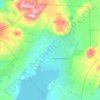
Syðstasúla topographic map

Click on the map to display elevation.

About this map

Name: Syðstasúla topographic map, elevation, terrain.

Location: Syðstasúla, Bláskógabyggð, Southern Region, Iceland (64.33662 -21.16088 64.33672 -21.16078)

Average elevation: 710 m

Minimum elevation: 380 m

Maximum elevation: 1,063 m

Other topographic maps

Click on a map to view its topography, its elevation and its terrain.

Gullfoss

Iceland > Bláskógabyggð

Average elevation: 214 m

Laugarvatn

Iceland > Bláskógabyggð > Laugarvatn

Average elevation: 67 m

Gear up for your next adventure:

🔋Rechargeable Batteries - Eco-friendly power for headlamps and GPS units
🧴Hiking Sunscreen - Sun protection for long exposure
🖼️Vintage Irish Map Prints - Decorative wall art for map lovers and geographers
📡Satellite Messengers - Emergency messaging when off‑grid
📸Travel Camera Tripods - Steady shots for landscape and long-exposure photos

As an Amazon Associate, this site earns from qualifying purchases at no extra cost to you.