Geolocate

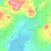
Strokkur topographic map

Click on the map to display elevation.

About this map

Name: Strokkur topographic map, elevation, terrain.

Location: Strokkur, Biskupstungnabraut, Bláskógabyggð, Southern Region, Iceland (64.31265 -20.30082 64.31275 -20.30072)

Average elevation: 115 m

Minimum elevation: 85 m

Maximum elevation: 342 m

Other topographic maps

Click on a map to view its topography, its elevation and its terrain.

Gullfoss

Iceland > Bláskógabyggð

Average elevation: 214 m

Laugarvatn

Iceland > Bláskógabyggð > Laugarvatn

Average elevation: 67 m

Gear up for your next adventure:

🦯Lightweight Trekking Poles - Reduce knee strain on steep Wicklow or Kerry slopes
🚶‍♂️Trekking Poles - Supportive poles for stability on varied terrain
🧭Sighting Compasses - Professional grade mirror compass for precise orientation
⌚Smart Watches for Hiking - Track performance on trails
🔦UV Flashlights - Search for minerals or inspect maps at night

As an Amazon Associate, this site earns from qualifying purchases at no extra cost to you.