
秣陵街道 topographic map
Interactive map
Click on the map to display elevation.
About this map
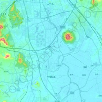
Name: 秣陵街道 topographic map, elevation, terrain.
Location: 秣陵街道, 江宁区, 南京市, 江苏省, 211100, 中国 (31.78964 118.70081 31.96061 118.87582)
Average elevation: 20 m
Minimum elevation: 3 m
Maximum elevation: 234 m
Other topographic maps
Click on a map to view its topography, its elevation and its terrain.