
淳化街道 topographic map
Interactive map
Click on the map to display elevation.
About this map
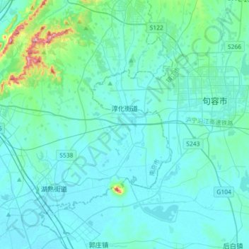
Name: 淳化街道 topographic map, elevation, terrain.
Location: 淳化街道, 江宁区, 南京市, 江苏省, 211198, 中国 (31.86210 118.83020 31.98574 119.11443)
Average elevation: 30 m
Minimum elevation: 4 m
Maximum elevation: 272 m
Other topographic maps
Click on a map to view its topography, its elevation and its terrain.