
张肖庄 topographic map
Interactive map
Click on the map to display elevation.
About this map
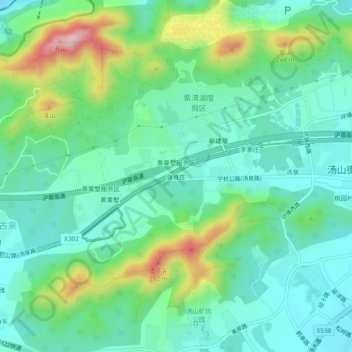
Name: 张肖庄 topographic map, elevation, terrain.
Location: 张肖庄, 汤山街道, 江宁区, 南京市, 江苏省, 211131, 中国 (32.03949 119.01043 32.07949 119.05043)
Average elevation: 104 m
Minimum elevation: 25 m
Maximum elevation: 318 m
Other topographic maps
Click on a map to view its topography, its elevation and its terrain.