
خزندار topographic map
Interactive map
Click on the map to display elevation.
About this map
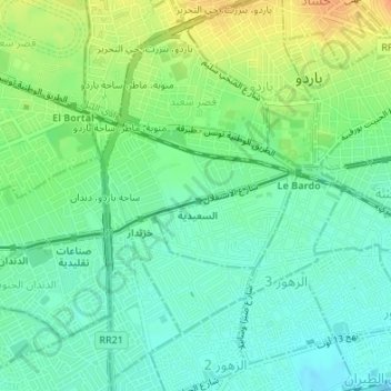
Name: خزندار topographic map, elevation, terrain.
Location: خزندار, باردو, Tunis, Tunisia (36.80079 10.11835 36.81082 10.13561)
Average elevation: 24 m
Minimum elevation: 9 m
Maximum elevation: 48 m
Other topographic maps
Click on a map to view its topography, its elevation and its terrain.