
Tunis topographic map
Interactive map
Click on the map to display elevation.
About this map
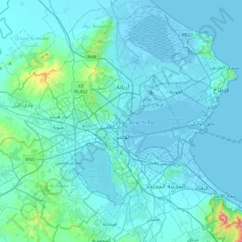
Name: Tunis topographic map, elevation, terrain.
Location: Tunis, Tunisia (36.69251 10.00379 36.94302 10.35481)
Average elevation: 37 m
Minimum elevation: -7 m
Maximum elevation: 542 m
Other topographic maps
Click on a map to view its topography, its elevation and its terrain.