Geolocate

Pemalang topographic map

Interactive map

Click on the map to display elevation.

About this map

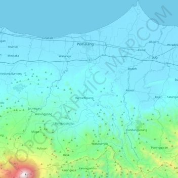
Name: Pemalang topographic map, elevation, terrain.

Location: Pemalang, Central Java, 52361, Indonesia (-7.24889 109.18559 -6.77227 109.59920)

Average elevation: 294 m

Minimum elevation: -1 m

Maximum elevation: 3,408 m

Other topographic maps

Click on a map to view its topography, its elevation and its terrain.

Bitaran

Indonesia > Central Java > Klaten > Keprabon

Average elevation: 170 m

Klampok

Indonesia > Central Java > Banjarnegara

Average elevation: 54 m

gembong

Indonesia > Central Java > Pekalongan

Average elevation: 737 m

Bukateja

Indonesia > Central Java > Purbalingga

Average elevation: 51 m

Karangrejo

Indonesia > Central Java > Magelang > Karangrejo

Average elevation: 277 m

Winong

Indonesia > Central Java > Winong

Average elevation: 17 m