
中原区 topographic map
Interactive map
Click on the map to display elevation.
About this map
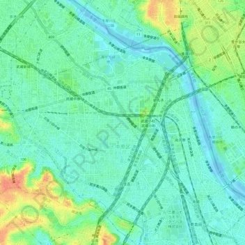
Name: 中原区 topographic map, elevation, terrain.
Location: 中原区, 川崎市, 神奈川縣, 日本 (35.55247 139.62689 35.59818 139.68521)
Average elevation: 15 m
Minimum elevation: -5 m
Maximum elevation: 50 m
中原區位於川崎市的中部,東北隔多摩川與東京都相鄰,矢上川流經西南側,全區多為平原地形。
Other topographic maps
Click on a map to view its topography, its elevation and its terrain.