
Asker topographic map
Interactive map
Click on the map to display elevation.
About this map
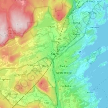
Name: Asker topographic map, elevation, terrain.
Location: Asker, Viken, 1384, Norway (59.79535 10.39356 59.87535 10.47356)
Average elevation: 149 m
Minimum elevation: -1 m
Maximum elevation: 449 m
Other topographic maps
Click on a map to view its topography, its elevation and its terrain.