
Lažiše topographic map
Interactive map
Click on the map to display elevation.
About this map
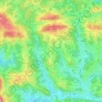
Name: Lažiše topographic map, elevation, terrain.
Location: Lažiše, Dobje, 3224, Slovenia (46.10981 15.35302 46.14981 15.39302)
Average elevation: 514 m
Minimum elevation: 408 m
Maximum elevation: 696 m
Other topographic maps
Click on a map to view its topography, its elevation and its terrain.
Ljubljanica
Slovenia > Ljubljana > Podgrad
Ljubljanica, Podgrad, Ljubljana, Upravna Enota Ljubljana, Slovenia
Average elevation: 393 m