
西区 topographic map
Interactive map
Click on the map to display elevation.
About this map
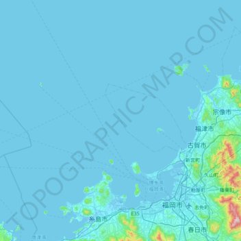
Name: 西区 topographic map, elevation, terrain.
Location: 西区, 福冈市, 福冈县, 日本 (33.50503 129.87164 34.06269 130.34625)
Average elevation: 25 m
Minimum elevation: -5 m
Maximum elevation: 909 m
Other topographic maps
Click on a map to view its topography, its elevation and its terrain.