
Ballymacoda topographic map
Interactive map
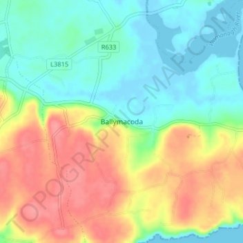
Click on the map to display elevation.
About this map
Name: Ballymacoda topographic map, elevation, terrain.
Average elevation: 30 m
Minimum elevation: -2 m
Maximum elevation: 73 m
County Cork trails, hiking, mountain biking, running and outdoor activities
Other topographic maps
Click on a map to view its topography, its elevation and its terrain.
Cork
The climate of Cork, like the majority of Ireland, is mild oceanic (Cfb in the Köppen climate classification) and changeable with abundant rainfall and a lack of temperature extremes. Cork lies in plant Hardiness zone 9b. Met Éireann maintains a climatological weather station at Cork Airport, a few…
Average elevation: 79 m
Whiddy Island
Whiddy Island (Irish: Oileán Faoide) is an island near the head of Bantry Bay in Ireland. It is approximately 5.6 km (3.5 mi) long and 2.4 km (1.5 mi) wide. The topography comprises gently-rolling glacial till, with relatively fertile soil. As late as 1880 the island had a resident population of around 450,…
Average elevation: 5 m
Great Island
In the 19th century Topographical Dictionary of Ireland (published by Samuel Lewis in 1837), Great Island is described as "very fertile" with its "light productive soil" supporting agricultural uses with "two-thirds [of the island] under tillage, and the remainder in pasture or included in demesnes". Lewis…
Average elevation: 20 m
Cork
The climate of Cork, like the majority of Ireland, is mild oceanic (Cfb in the Köppen climate classification) and changeable with abundant rainfall and a lack of temperature extremes. Cork lies in plant Hardiness zone 9b. Met Éireann maintains a climatological weather station at Cork Airport, a few…
Average elevation: 79 m