
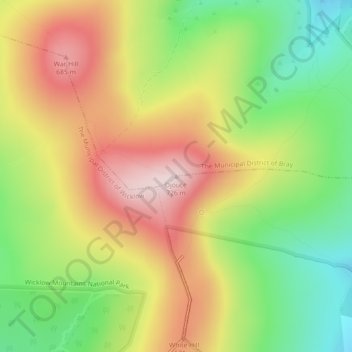
Djouce topographic map
Interactive map
Click on the map to display elevation.
About this map
Name: Djouce topographic map, elevation, terrain.
Average elevation: 534 m
Minimum elevation: 359 m
Maximum elevation: 720 m
County Wicklow trails, hiking, mountain biking, running and outdoor activities
Other topographic maps
Click on a map to view its topography, its elevation and its terrain.
Baltinglass
A nineteenth-century explanation is found in Samuel Lewis' A Topographical Dictionary of Ireland, where he says that the name, "according to most antiquaries," comes from Baal-Tin-Glas, meaning the "pure fire of Baal," and that this suggests that the area was a centre for "druidical worship".
Average elevation: 163 m