
The Rocks at Priestnewtown topographic map
Click on the map to display elevation.
About this map
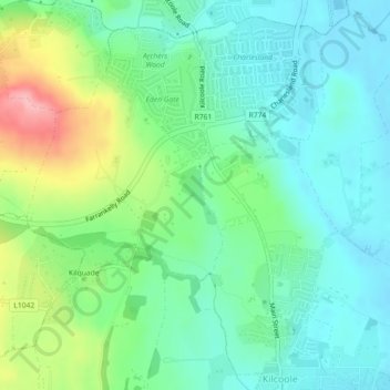
Name: The Rocks at Priestnewtown topographic map, elevation, terrain.
Average elevation: 44 m
Minimum elevation: 6 m
Maximum elevation: 138 m
County Wicklow trails, hiking, mountain biking, running and outdoor activities
Other topographic maps
Click on a map to view its topography, its elevation and its terrain.
Greystones
Greystones is located south of the site of an ancient castle of the Barony of Rathdown. There was a hamlet which, like Rathdown Castle, was known as Rathdown, and which appeared on a 1712 map. This site occupied an area now known as the Grove, north of Greystones harbour, but only the ruins of a chapel, St.…
Average elevation: 49 m
Baltinglass
A nineteenth-century explanation is found in Samuel Lewis' A Topographical Dictionary of Ireland, where he says that the name, "according to most antiquaries," comes from Baal-Tin-Glas, meaning the "pure fire of Baal," and that this suggests that the area was a centre for "druidical worship".
Average elevation: 163 m
Stratford
Ireland > County Wicklow > Stratford
According to Lewis's Topographical Dictionary of 1837, Stratford-upon-Slaney was at that time a market town in the barony of Upper Talbotstown 2¼ miles north north east of Baltinglass. At that time the town had 2,833 inhabitants. In 1837 Orr and Co. bought the factory from the Stratford family. It employed…
Average elevation: 174 m
Macreddin
The elevation of Carysfort was too high and settlers soon moved south down the valley to Aughrim. In the eighteenth century there was still a fairground at the crossroads, with "riotous" two-day fairs held at Whitsun and All Saints. Michael Dwyer stayed in Macreddin when repairing to the Wicklow Mountains…
Average elevation: 224 m
Lugnaquilla
Lugnaquilla is the 432nd-highest and 21st most prominent mountain in Britain and Ireland, on the Simms classification. It is regarded by the Scottish Mountaineering Club (SMC) as one of 34 Furths, which is a mountain above 3,000 ft (914 m) in elevation, and meets the other SMC criteria for a Munro (e.g.…
Average elevation: 696 m