
奈半利町 topographic map
Interactive map
Click on the map to display elevation.
About this map
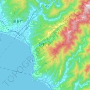
Name: 奈半利町 topographic map, elevation, terrain.
Location: 奈半利町, 安藝郡, 高知县, 日本 (33.37836 133.98218 33.44884 134.10873)
Average elevation: 213 m
Minimum elevation: 0 m
Maximum elevation: 922 m
Other topographic maps
Click on a map to view its topography, its elevation and its terrain.