
Mbuji-Mayi topographic map
Interactive map
Click on the map to display elevation.
About this map
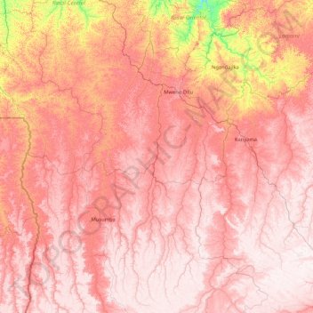
Name: Mbuji-Mayi topographic map, elevation, terrain.
Location: Mbuji-Mayi, Democratic Republic of the Congo (-9.35421 22.94914 -6.02834 23.74668)
Average elevation: 891 m
Minimum elevation: 509 m
Maximum elevation: 1,139 m
Other topographic maps
Click on a map to view its topography, its elevation and its terrain.
Kinshasa
Democratic Republic of the Congo > Kinshasa
Geographically covering 9,965 square kilometers, Kinshasa stretches along the southern shores of the Pool Malebo, forming an expansive crescent across flat, low-lying terrain at an average altitude of about 300 meters. Situated between latitudes 4° and 5° and longitudes East 15° and 16°32, Kinshasa shares…
Average elevation: 316 m