
Qeqqata topographic map
Interactive map
Click on the map to display elevation.
About this map
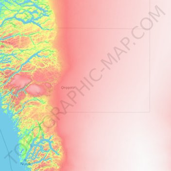
Name: Qeqqata topographic map, elevation, terrain.
Location: Qeqqata, Greenland (64.37012 -54.63986 67.78579 -44.00000)
Average elevation: 1,504 m
Minimum elevation: -6 m
Maximum elevation: 2,810 m
Other topographic maps
Click on a map to view its topography, its elevation and its terrain.