Geolocate

Charleston topographic map

Click on the map to display elevation.

About this map
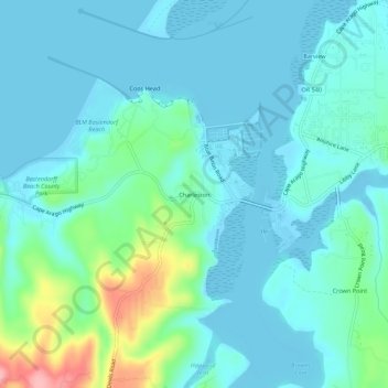
Name: Charleston topographic map, elevation, terrain.

Location: Charleston, Coos County, Oregon, 92443, United States (43.32001 -124.35024 43.36001 -124.31024)

Average elevation: 24 m

Minimum elevation: -5 m

Maximum elevation: 132 m

Other topographic maps

Click on a map to view its topography, its elevation and its terrain.

Bandon

United States > Oregon > Coos County

Average elevation: 22 m

North Bend

United States > Oregon > Coos County

Average elevation: 11 m

Bunker Hill

United States > Oregon > Coos County

Average elevation: 20 m

Gear up for your next adventure:

🧢Waterproof Caps - Keep rain off your face and glasses while hiking
🧼Biodegradable Soaps - Eco‑friendly soap for backpacking
📊Altimeters & Barometers - Track elevation and weather changes
🔨Multi-tool Devices - Versatile tools for gear repairs in the field
🧴Hiking Sunscreen - Sun protection for long exposure

As an Amazon Associate, this site earns from qualifying purchases at no extra cost to you.