

United States topographic maps
Click on a map to view its topography, its elevation and its terrain.
Upper Peninsula
Including extensive parts of the Great Lakes, the Upper Peninsula contains about 36,139 square miles (93,600 km2) of total area. Of that, about 16,378 square miles (42,420 km2) is its land area, about 29% of the state. It is bounded on the north by Lake Superior, on the east by St. Marys River, on the south by…
Average elevation: 274 m

Salt Lake City
United States > Utah > Salt Lake County > Salt Lake City
Salt Lake City has an area of 110.4 square miles (286 km2) and an average elevation of 4,327 feet (1,319 m) above sea level. The lowest point within the boundaries of the city is 4,210 feet (1,280 m) near the Jordan River and the Great Salt Lake, and the highest is Grandview Peak, at 9,410 feet (2,868 m).
Average elevation: 1,625 m


Jacksonville
United States > Florida > Duval County > Jacksonville
Just south of Jacksonville and north of Saint Augustine is the boundary of where the Floridian Peninsula ends and Continental North America begins; Jacksonville is north of that line. While still in the North American Coastal plain, the topography begins to take on slight Piedmont characteristics. Like the…
Average elevation: 9 m

Minneapolis
United States > Minnesota > Hennepin County > Minneapolis
A 1959 report by the U.S. Soil Conservation Service listed Minneapolis's elevation as 830 feet (250 m). The city's lowest elevation of 687 feet (209 m) above sea level is near where Minnehaha Creek meets the Mississippi River. Sources disagree on the exact location and elevation of the city's highest point,…
Average elevation: 271 m


Lake Superior
American limnologist J. Val Klump was the first person to reach the lowest depth of Lake Superior on July 30, 1985, as part of a scientific expedition, which at 122 fathoms 1 foot (733 ft or 223 m) below sea level is the second-lowest spot in the continental interior of the United States and the third-lowest…
Average elevation: 318 m
Sioux City
United States > Iowa > Woodbury County
Sioux City is located at 42°29′44″N 96°23′26″W / 42.495668°N 96.390525°W / 42.495668; -96.390525.[1] Sioux City lies at an altitude of 1,135 ft (345.9 m) above sea level. Sioux City borders two states, South Dakota to the west-northwest and Nebraska to the west. According to the United…
Average elevation: 352 m

Palm Beach
United States > Florida > Palm Beach County
Palm Beach is one of the easternmost towns in Florida, though the state's easternmost point is in Palm Beach Shores, just north of Lake Worth Inlet. The town is on an 18-mile (29 km) long barrier island between the Intracoastal Waterway (locally known as the Lake Worth Lagoon) on the west and the Atlantic…
Average elevation: 4 m

Niagara Escarpment
United States > New York > Niagara County > City of Lockport
Average elevation: 165 m
West Tennessee
West Tennessee is located almost entirely within the Mississippi Embayment, part of the Gulf Coastal Plain. Because of this, the terrain is flatter than the eastern parts of the state. Areas along the Mississippi River are located within the Mississippi Alluvial Plain, which is primarily a floodplain with many…
Average elevation: 127 m
Ellensburg
United States > Washington > Kittitas County > Ellensburg > Ellensburg
Average elevation: 485 m

Gaylord
United States > Michigan > Otsego County > Gaylord
Gaylord became a city in 1922. The change from village to city required a vote by town residents. For reasons that are unclear, the margin of passage was a very close 21 votes — 114 people in favor to 93 against. John Hamilton was elected the first mayor of Gaylord. Over the years, the community continued to…
Average elevation: 401 m

Indio
United States > California > Riverside County
Indio is home of Riverside County's eastern administration offices. Palm Springs had more people from 1955 to 1992, when the US census announced that Indio surpassed Palm Springs and that title was returned to them. The official elevation of Indio is below sea level; the city hall is 14 feet (4 m) below sea…
Average elevation: 74 m

Cripple Creek
United States > Colorado > Teller County
For many years, Cripple Creek's high valley, at an elevation of 9,494 feet (2,894 m), was considered no more important than a cattle pasture. Many prospectors avoided the area after the Mount Pisgah hoax, a mini gold rush caused by salting (adding gold to worthless rock).
Average elevation: 2,946 m

Lake Erie
Situated below Lake Huron, Erie's primary inlet is the Detroit River. The main natural outflow from the lake is via the Niagara River, which provides hydroelectric power to Canada and the U.S. as it spins huge turbines near Niagara Falls at Lewiston, New York, and Queenston, Ontario. Some outflow occurs via…
Average elevation: 267 m


Lake Michigan
Lake Michigan (/ˈmɪʃɪɡən/ MISH-ig-ən) is one of the five Great Lakes of North America. It is the second-largest of the Great Lakes by volume (1,180 cu mi (4,900 km3)) and depth (923 ft (281 m)) after Lake Superior and the third-largest by surface area (22,405 sq mi (58,030 km2)), after Lake Superior and…
Average elevation: 260 m


St. Clair River
United States > Michigan > SaintClair
The river is 40.5 miles (65.2 km) long and drops 5 feet (2 m) in elevation from Lake Huron to Lake St. Clair. The flow rate averages around 182,000 cubic feet per second (5,200 m3/s), and the drainage area is 223,600 square miles (579,000 km2). This takes into account the combined drainage areas of Lakes…
Average elevation: 191 m


Desert Hot Springs
United States > California > Riverside County
Summer winds and the higher elevation keep Desert Hot Springs on average 5-7 degrees cooler than other communities in Coachella Valley. However, the winter season can be warmer due to the surrounding mountains blocking north winds. Since it lies at a higher elevation than the cities further south, cold air…
Average elevation: 498 m
Claremont
United States > New Hampshire > Sullivan County
The city is in western Sullivan County and is bordered to the west by the Connecticut River, the boundary between New Hampshire and Vermont. According to the United States Census Bureau, the city has a total area of 44.1 square miles (114.1 km2), of which 43.2 square miles (111.8 km2) are land and 0.89 square…
Average elevation: 236 m


Village of Mamaroneck
United States > New York > Westchester County
Other areas of the town include Heathcote Hill overlooking the harbor, Harbor Heights (the heights) to the northeast, Old Rye Neck (settled in the 1880s), Rye Neck (settled in the 1920s and 1930s), Orienta, and Washingtonville, better known as "The Flats", due to the flat, low-lying topography of the area.
Average elevation: 15 m
Casper Mountain
United States > Wyoming > Natrona County
Casper Mountain, an anticline, is located at the north end of the Laramie Mountains overlooking Casper, Wyoming along the North Platte River. At a top elevation of 8,130 feet (2,478 m), the geological feature rises approximately 3,000 feet (914 m) above Casper.
Average elevation: 2,315 m


Utah County
Utah Valley lies at the center of the county, lined by the mountains of the Wasatch Range on the east. Utah Lake occupies a large part of the valley. The elevation ranges from 4,487 feet (1,368 m) above sea level at the lake to 11,928 feet (3,636 m) at the peak of Mount Nebo.
Average elevation: 2,016 m
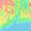
New Haven County
United States > Connecticut > South Central Connecticut Planning Region
The terrain is mostly flat near the coast, with low hills defining the rest of the area, rising significantly only in the north of the county. The highest elevation is close to the northernmost point in the county, found at two areas of approximately 1,050 feet (320 m) above sea level in the town of Wolcott.…
Average elevation: 89 m


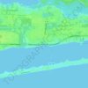
Navarre
United States > Florida > Santa Rosa County
Navarre is located at 30°24′04″N 86°51′47″W / 30.401°N 86.863°W / 30.401; -86.863Coordinates: 30°24′04″N 86°51′47″W / 30.401°N 86.863°W / 30.401; -86.863. It is located within a portion of the Florida Panhandle observing the Central Time Zone. Elevation is at an average of 10 feet (3.0 m).
Average elevation: 4 m
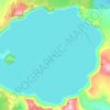
Crater Lake
United States > Oregon > Klamath County
The lake is 5 by 6 miles (8.0 by 9.7 km) across, with a caldera rim ranging in elevation from 7,000 to 8,000 feet (2,100 to 2,400 m) and an average lake depth of 1,148 feet (350 m). The lake's maximum depth has been measured at 1,949 feet (594 m), which fluctuates slightly as the weather changes. On the basis…
Average elevation: 1,971 m
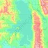


Big Bear City
United States > California > San Bernardino County
It is estimated that the Serrano natives first settled in Big Bear between 1,500 and 2,000 years ago. The Serranos had both winter and summer settlements throughout the area. While their winter village was located in Lucerne Valley, they relocated to villages in the San Bernardino mountains during summer, as…
Average elevation: 2,155 m

Death Valley National Park
United States > California > Inyokern
There are two major valleys in the park, Death Valley and Panamint Valley. Both of these valleys were formed within the last few million years and both are bounded by north–south-trending mountain ranges. These and adjacent valleys follow the general trend of Basin and Range topography with one modification:…
Average elevation: 1,177 m

Seneca Lake
United States > New York > Schuyler County > Town of Dix > Town of Romulus
Average elevation: 291 m

Kings Canyon National Park
United States > California > Fresno County
Kings Canyon is characterized by some of the steepest vertical relief in North America, with numerous peaks over 14,000 feet (4,300 m) on the Sierra Crest along the park's eastern border, falling to 4,500 feet (1,400 m) in the valley floor of Cedar Grove just ten miles (16 km) to the west. The Sierran crest…
Average elevation: 2,591 m


Abbeville
United States > Louisiana > Vermilion Parish
Abbeville is located at 29°58′31.422″N 92°7′37.7652″W / 29.97539500°N 92.127157000°W / 29.97539500; -92.127157000[9] and has an elevation of 16 feet (4.9 m).[10] According to the United States Census Bureau, the town has a total area of 5.7 square miles (14.7629 km2), of which 5.7 square…
Average elevation: 5 m

Three Sisters
United States > Oregon > Deschutes County
The Three Sisters are closely spaced volcanic peaks in the U.S. state of Oregon. They are part of the Cascade Volcanic Arc, a segment of the Cascade Range in western North America extending from southern British Columbia through Washington and Oregon to Northern California. Each more than 10,000 feet (3,000 m)…
Average elevation: 2,526 m





Bellingham
United States > Massachusetts > Bellingham
According to the United States Census Bureau, the town has a total area of 19.0 square miles (49.2 km2), of which 18.5 square miles (47.9 km2) is land and 0.5 square mile (1.3 km2) (2.58%) is water. The town's mean elevation is 293 feet (89 m) above sea level.
Average elevation: 84 m


June Lake
United States > California > Mono County
June Lake is an unincorporated community and census-designated place (CDP) in Mono County, California, United States. It is located against the southern rim of the Mono Basin, 12.5 miles (20 km) south of Lee Vining, at an elevation of 7,654 feet (2,333 m).
Average elevation: 2,548 m
Jaffrey
United States > New Hampshire > Cheshire County
Thorndike Pond is in the north, and Contoocook Lake is on the southern boundary. Mount Monadnock, elevation 3,165 feet (965 m) and the highest point in Jaffrey as well as Cheshire County, is in the northwest. Jaffrey lies mostly within the Merrimack River watershed, via the Contoocook River in the eastern part…
Average elevation: 351 m


Mojave
United States > California > Kern County
Mojave (formerly Mohave) is an unincorporated community in Kern County, California, United States. Mojave is located 50 miles (80 km) east of Bakersfield, and 100 miles (161 km) north of Los Angeles, at an elevation of 2,762 feet (842 m). The town is located in the western region of the Mojave Desert, below…
Average elevation: 857 m
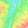
Littleton
United States > Colorado > Arapahoe County > Littleton > Littleton
Littleton is located at 39°35′59″N 105°0′39″W / 39.59972°N 105.01083°W / 39.59972; -105.01083 (39.599691, −105.010929) at an elevation of 5,351 feet (1,631 m). Located in central Colorado at the junction of U.S. Route 85 and Colorado State Highway 470, the city is 9 miles (14 km) south…
Average elevation: 1,656 m


Texas City
United States > Texas > Galveston County
Officially, the elevation of Texas City is 10 feet above sea level, though some areas are even lower. It was naturally vulnerable to flooding by hurricane storm surges and heavy rainstorms.
Average elevation: 2 m
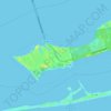

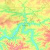

Stevens Pass
United States > Washington > King County
Stevens Pass (elevation 4,061 ft (1,238 m)) is a mountain pass through the Cascade Mountains located at the border of King County and Chelan County in Washington, United States. U.S. Route 2 travels over the pass, reaching a maximum elevation of 4,061 feet (1,238 m). The Pacific Crest Trail crosses the highway…
Average elevation: 1,387 m

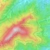
Grandfather Mountain State Park
United States > North Carolina > Watauga County > Banner Elk
Grandfather Mountain rises 5,964 feet above sea level, and due to the considerable elevation gain the mountain boasts 16 distinct ecological communities. The mountain is famous for its rugged character, and is home to many hidden caves and significant cliffs.
Average elevation: 1,293 m


Indianapolis
United States > Indiana > Marion County
Indianapolis is located within a physiographic province known as the Tipton Till Plain, a flat, gently rolling terrain underlain by glacial deposits known as till. The lowest point in the city is about 650 feet (198 m) above mean sea level, with the highest natural elevation at about 900 feet (274 m) above sea…
Average elevation: 241 m

Suwannee River
The headwaters of the Suwannee River are in the Okefenokee Swamp in the town of Fargo, Georgia. The river runs southwestward into the Florida Panhandle, then drops in elevation through limestone layers into a rare Florida whitewater rapid. Past the rapid, the Suwanee turns west near the town of White Springs,…
Average elevation: 30 m


