Geolocate

Etchingham topographic map

Click on the map to display elevation.

About this map
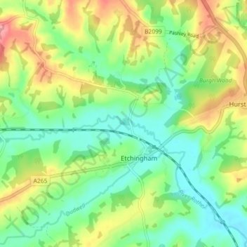
Name: Etchingham topographic map, elevation, terrain.

Location: Etchingham, Rother, East Sussex, England, United Kingdom (50.99364 0.39071 51.03614 0.46220)

Average elevation: 46 m

Minimum elevation: 9 m

Maximum elevation: 108 m

Gear up for your next adventure:

🎒Waterproof Backpacks - Protect your gear from rain on Irish hikes
🎿Skiing Gear - Winter sports essentials
🌂Windproof Trekking Umbrellas - Protection during vertical Irish rain
🎒Fully Waterproof Rucksacks - Submersible protection for river crossings
🕶️Polarized Sunglasses - Reduce glare outdoors

As an Amazon Associate, this site earns from qualifying purchases at no extra cost to you.