
Saint Vith topographic map
Interactive map
Click on the map to display elevation.
About this map
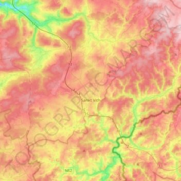
Name: Saint Vith topographic map, elevation, terrain.
Location: Saint Vith, Verviers, Liège, Wallonia, 4780, Belgium (50.23011 5.97866 50.35284 6.30903)
Average elevation: 492 m
Minimum elevation: 287 m
Maximum elevation: 648 m
Other topographic maps
Click on a map to view its topography, its elevation and its terrain.
Andler
Belgium > Liège > Verviers > Saint Vith
Andler, Saint Vith, Verviers, Liège, Wallonia, 4780, Belgium
Average elevation: 497 m