
Moresnet topographic map
Interactive map
Click on the map to display elevation.
About this map
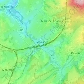
Name: Moresnet topographic map, elevation, terrain.
Location: Moresnet, Plombières, Verviers, Liège, Wallonia, 4850, Belgium (50.70087 5.96804 50.74087 6.00804)
Average elevation: 201 m
Minimum elevation: 141 m
Maximum elevation: 339 m