Geolocate

Maple Falls topographic map

Click on the map to display elevation.

About this map
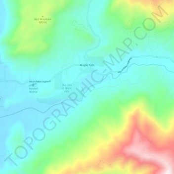
Name: Maple Falls topographic map, elevation, terrain.

Location: Maple Falls, Whatcom County, Washington, United States (48.89188 -122.14660 48.93709 -122.03118)

Average elevation: 442 m

Minimum elevation: 122 m

Maximum elevation: 1,419 m

Other topographic maps

Click on a map to view its topography, its elevation and its terrain.

Gear up for your next adventure:

🚲Cycling GPS Computers - Topographic mapping for Irish road and mountain biking
🎒Hiking Backpacks - Durable backpacks for day hikes and multi‑day treks
🩻Outdoor Health Essentials - Necessary health items for hikes
🌍Travel Adapters - Adapters for international travel
🖊️All-Weather Pens - Pressurized ink cartridges that write upside down and in wet

As an Amazon Associate, this site earns from qualifying purchases at no extra cost to you.