Geolocate

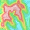
Logan Point topographic map

Click on the map to display elevation.

About this map

Name: Logan Point topographic map, elevation, terrain.

Location: Logan Point, Huntsville, Madison County, Alabama, 35811, United States (34.75365 -86.50782 34.75375 -86.50772)

Average elevation: 347 m

Minimum elevation: 213 m

Maximum elevation: 504 m

Other topographic maps

Click on a map to view its topography, its elevation and its terrain.
Gear up for your next adventure:

🚨High-Decibel Whistles - Standard safety gear for mountain signaling
📦Outdoor Storage Bags - Keep gear organized and dry
🧢Waterproof Caps - Keep rain off your face and glasses while hiking
🥽UV Protection Sunglasses - Protect eyes on bright days
🧴Hiking Sunscreen - Sun protection for long exposure

As an Amazon Associate, this site earns from qualifying purchases at no extra cost to you.