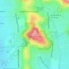
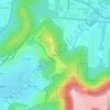
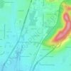
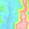
Click on a map to view its topography, its elevation and its terrain.
United States > Alabama > Madison County > Huntsville
Average elevation: 351 m
Average elevation: 194 m
Average elevation: 305 m
Average elevation: 213 m
Average elevation: 207 m
Average elevation: 184 m
Average elevation: 255 m
Average elevation: 260 m
Average elevation: 183 m
Average elevation: 288 m
Average elevation: 271 m
Average elevation: 180 m
Average elevation: 310 m
Average elevation: 195 m
Average elevation: 347 m
Average elevation: 236 m
Average elevation: 197 m
Average elevation: 215 m
Average elevation: 280 m
Average elevation: 221 m
Average elevation: 203 m
Average elevation: 269 m
As an Amazon Associate, this site earns from qualifying purchases at no extra cost to you.