
Karakoram Pass topographic map
Interactive map
Click on the map to display elevation.
About this map
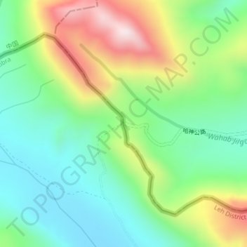
Name: Karakoram Pass topographic map, elevation, terrain.
Location: Karakoram Pass, Nubra, Leh District, Ladakh, India (35.51341 77.82265 35.51351 77.82275)
Average elevation: 5,521 m
Minimum elevation: 5,300 m
Maximum elevation: 5,931 m
Historically, the high altitude of the pass and the lack of fodder were responsible for the deaths of countless pack animals while the route was notorious for the trail of bones strewn along the way. There is an almost total absence of vegetation on the approaches to the pass.
Other topographic maps
Click on a map to view its topography, its elevation and its terrain.
Siachen Glacier
Siachen Glacier, Nubra, Leh district, Ladakh, India
Average elevation: 5,448 m
Daulat Beg Oldi
Daulat Beg Oldi, Nubra, Leh district, Ladakh, India
Average elevation: 5,085 m