
Make a donation
Gear up for your next adventure:
As an Amazon Associate, this site earns from qualifying purchases at no extra cost to you.
Fresno topographic map
Click on the map to display elevation.
Make a donation
Gear up for your next adventure:
As an Amazon Associate, this site earns from qualifying purchases at no extra cost to you.
About this map
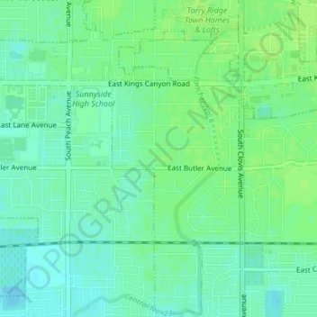
Name: Fresno topographic map, elevation, terrain.
Location: Fresno, Fresno County, California, United States (36.72845 -119.70935 36.73044 -119.70836)
Average elevation: 98 m
Minimum elevation: 92 m
Maximum elevation: 102 m
Make a donation
Gear up for your next adventure:
As an Amazon Associate, this site earns from qualifying purchases at no extra cost to you.
Other topographic maps
Click on a map to view its topography, its elevation and its terrain.
Kings Canyon National Park
United States > California > Fresno County
Kings Canyon is characterized by some of the steepest vertical relief in North America, with numerous peaks over 14,000 feet (4,300 m) on the Sierra Crest along the park's eastern border, falling to 4,500 feet (1,400 m) in the valley floor of Cedar Grove just ten miles (16 km) to the west. The Sierran crest…
Average elevation: 2,591 m
Clovis
United States > California > Fresno County > Clovis
Clovis is a city in Fresno County, California, United States. The 2020 population was 120,124. Clovis is located 6.5 miles (10.5 km) northeast of downtown Fresno, at an elevation of 361 feet (110 m).
Average elevation: 127 m
Make a donation
Gear up for your next adventure:
As an Amazon Associate, this site earns from qualifying purchases at no extra cost to you.