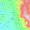
Alston topographic map
Click on the map to display elevation.
Alston
Alston is a town in Westmorland and Furness, Cumbria, England, within the civil parish of Alston Moor on the River South Tyne. It shares the title of the 'highest market town in England', at about 1,000 feet (300 m) above sea level, with Buxton, Derbyshire. Despite its altitude, the town is easily accessible via the many roads which link the town to Weardale, Teesdale, and towns in Cumbria such as Penrith via Hartside Pass, as well as Tynedale. Historically part of Cumberland, Alston lies within the North Pennines, a designated Area of Outstanding Natural Beauty. Much of the town centre is a designated Conservation Area which includes several listed buildings.
About this map
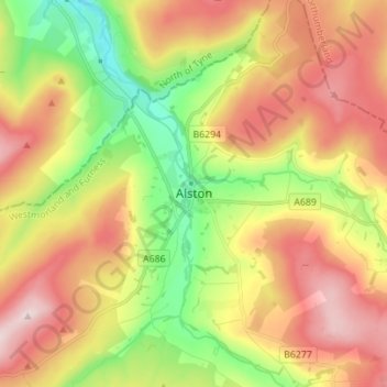
Name: Alston topographic map, elevation, terrain.
Average elevation: 404 m
Minimum elevation: 218 m
Maximum elevation: 599 m
Other topographic maps
Click on a map to view its topography, its elevation and its terrain.
Barrow-in-Furness
United Kingdom > England > Westmorland and Furness > Askam-in-Furness
Average elevation: 22 m
Toddygill Plantation
United Kingdom > England > Westmorland and Furness > Warcop
Average elevation: 172 m