Geolocate

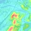
Ooltewah topographic map

Click on the map to display elevation.

About this map

Name: Ooltewah topographic map, elevation, terrain.

Location: Ooltewah, Hamilton County, East Tennessee, Tennessee, United States (35.03410 -85.12890 35.08124 -85.04323)

Average elevation: 267 m

Minimum elevation: 217 m

Maximum elevation: 389 m

Other topographic maps

Click on a map to view its topography, its elevation and its terrain.
Gear up for your next adventure:

🔦LED Flashlights - Bright, durable flashlights for outdoor use
🌧️Rain Gear for Hiking - Waterproof gear sets for wet hikes
⛺Ultralight Hiking Tents - Compact shelters for multi-day wild camping in Ireland
🧢Waterproof Caps - Keep rain off your face and glasses while hiking
📱Phone Holders for Biking - Secure phone mounts for touring cyclists

As an Amazon Associate, this site earns from qualifying purchases at no extra cost to you.