Geolocate

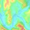
Sheregesh topographic map

Click on the map to display elevation.

About this map

Name: Sheregesh topographic map, elevation, terrain.

Location: Sheregesh, Tashtagolsky Municipal Okrug, Kemerovo Oblast–Kuzbass, Siberian Federal District, 652971, Russia (52.86386 87.86571 52.97610 88.03943)

Average elevation: 759 m

Minimum elevation: 509 m

Maximum elevation: 1,535 m

Other topographic maps

Click on a map to view its topography, its elevation and its terrain.

Gear up for your next adventure:

🚨High-Decibel Whistles - Standard safety gear for mountain signaling
🎒Technical Hiking Daypacks - Ergonomic backpacks with hydration bladder compatibility
🧥Packable Down Jackets - High warmth-to-weight ratio for summit breaks
🎁Outdoor Gift Ideas - Great gifts for adventurers
🪑Compact Camping Tables - Tables for campsite comfort

As an Amazon Associate, this site earns from qualifying purchases at no extra cost to you.