Geolocate

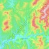
Kaz topographic map

Click on the map to display elevation.

About this map

Name: Kaz topographic map, elevation, terrain.

Location: Kaz, Tashtagolsky Municipal Okrug, Kemerovo Oblast–Kuzbass, Siberian Federal District, Russia (53.09904 87.52155 53.12597 87.63387)

Average elevation: 479 m

Minimum elevation: 324 m

Maximum elevation: 710 m

Other topographic maps

Click on a map to view its topography, its elevation and its terrain.

Gear up for your next adventure:

🫗Collapsible Water Bottles - Space‑saving hydration
🔋Rechargeable Batteries - Eco-friendly power for headlamps and GPS units
🔋Solar Power Banks - Keep your GPS and phone charged in the Irish wilderness
🛠️Tent Repair Kits - Fix tents on the trail
🩻Outdoor Health Essentials - Necessary health items for hikes

As an Amazon Associate, this site earns from qualifying purchases at no extra cost to you.