Geolocate

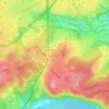
Berchem topographic map

Click on the map to display elevation.

About this map

Name: Berchem topographic map, elevation, terrain.

Location: Berchem, Kettwig, Stadtbezirk IX, Essen, North Rhine-Westphalia, 45219, Germany (51.36635 6.91532 51.40635 6.95532)

Average elevation: 100 m

Minimum elevation: 37 m

Maximum elevation: 165 m

Other topographic maps

Click on a map to view its topography, its elevation and its terrain.

Frohnhausen

Germany > North Rhine-Westphalia > Essen

Average elevation: 85 m

Schuir

Germany > North Rhine-Westphalia > Essen

Average elevation: 121 m

Kupferdreh

Germany > North Rhine-Westphalia > Essen

Average elevation: 126 m

45309

Germany > North Rhine-Westphalia > Essen

Average elevation: 63 m

Stadtwald

Germany > North Rhine-Westphalia > Essen

Average elevation: 114 m

Kray

Germany > North Rhine-Westphalia > Essen

Average elevation: 78 m

Nordviertel

Germany > North Rhine-Westphalia > Essen

Nordviertel has 7,308 inhabitants and is therefore one of the smallest boroughs of Essen. It has an area of 2.86 km² and its average elevation is 48 metres above sea level.

Average elevation: 62 m

Gear up for your next adventure:

🧦Hiking Socks - Comfortable socks to prevent blisters
🪑Compact Camping Tables - Tables for campsite comfort
🪢Paracord & Ropes - Strong ropes for camping and gear
🧴Long-Lasting Sunscreen - Protect against UV rays during long days on the ridges
🔗Locking Carabiners - Secure gear to your pack or for light climbing

As an Amazon Associate, this site earns from qualifying purchases at no extra cost to you.