Geolocate

Kray topographic map

Click on the map to display elevation.

About this map
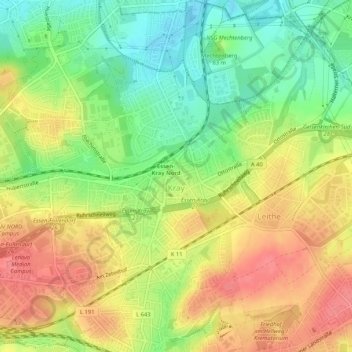
Name: Kray topographic map, elevation, terrain.

Location: Kray, Stadtbezirk VII, Essen, North Rhine-Westphalia, 45307, Germany (51.45166 7.05358 51.48416 7.10186)

Average elevation: 78 m

Minimum elevation: 41 m

Maximum elevation: 113 m

Other topographic maps

Click on a map to view its topography, its elevation and its terrain.

Berchem

Germany > North Rhine-Westphalia > Essen

Average elevation: 100 m

Gear up for your next adventure:

🥾Mountaineering Boots - Heavy‑duty boots for rugged peaks
🛶Kayaking & Water Sports Gear - Equip for water adventures
🌲Bushcraft Skills Books - Learn navigation, fire-making, and shelter building
🩰Hiking Binoculars - See long distances on trails
📱Rugged Smartphones - Waterproof phones with long battery for offline mapping

As an Amazon Associate, this site earns from qualifying purchases at no extra cost to you.