
Central Tapanuli topographic map
Interactive map
Click on the map to display elevation.
About this map
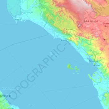
Name: Central Tapanuli topographic map, elevation, terrain.
Location: Central Tapanuli, North Sumatra, Sumatra, Indonesia (1.33651 97.64374 2.31144 99.06182)
Average elevation: 236 m
Minimum elevation: -1 m
Maximum elevation: 2,121 m
Other topographic maps
Click on a map to view its topography, its elevation and its terrain.