
平潮镇 topographic map
Interactive map
Click on the map to display elevation.
About this map
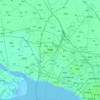
Name: 平潮镇 topographic map, elevation, terrain.
Location: 平潮镇, 通州区, 南通市, 江苏省, 226300, 中国 (32.00293 120.69220 32.20182 120.82292)
Average elevation: 4 m
Minimum elevation: -4 m
Maximum elevation: 21 m
Other topographic maps
Click on a map to view its topography, its elevation and its terrain.