Geolocate

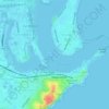
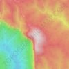
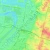
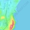
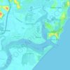
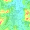
Red Head topographic map

Click on the map to display elevation.

About this map

Name: Red Head topographic map, elevation, terrain.

Location: Red Head, Mid-Coast Council, New South Wales, 2430, Australia, Shelly Beach (-32.05715 152.54559 -32.05469 152.54721)

Average elevation: 9 m

Minimum elevation: 0 m

Maximum elevation: 57 m

Other topographic maps

Click on a map to view its topography, its elevation and its terrain.
Sydney

Australia > New South Wales

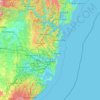
Sydney's topography is characterized by a diverse landscape that seamlessly blends coastal features with inland plateaus. The city is divided into two primary regions: the relatively flat Cumberland Plain to the south and west of Sydney Harbour, and the elevated Hornsby Plateau to the north. The Cumberland…

Average elevation: 51 m
Sydney

Australia > New South Wales

Phillip had been given no instructions for urban development, but in July 1788 submitted a plan for the new town at Sydney Cove. It included a wide central avenue, a permanent Government House, law courts, hospital and other public buildings, but no provision for warehouses, shops, or other commercial…

Average elevation: 32 m
Wollongong

Australia > New South Wales > Wollongong

Average elevation: 115 m

Karangi

Australia > New South Wales

Average elevation: 173 m

Wentworth Falls

Australia > New South Wales > Sydney

Wentworth Falls (postcode: 2782) is a town in the Blue Mountains region of New South Wales, situated approximately 100 kilometres (62 mi) west of the Sydney central business district, and about 8 kilometres (5.0 mi) east of Katoomba, Australia on the Great Western Highway, with a Wentworth Falls railway…

Average elevation: 708 m
Lismore

Australia > New South Wales

Average elevation: 23 m

Newcastle

Australia > New South Wales > Newcastle

Average elevation: 5 m

Mount Banks

Australia > New South Wales

Mount Banks, otherwise known as Mount King George, is a mountain within the Explorers Range of the Blue Mountains Range that is a spur off the Great Dividing Range, is located within the Blue Mountains National Park, approximately 100 kilometres (62 mi) west of Sydney in New South Wales, Australia. Mount Banks…

Average elevation: 745 m
Barrington Tops

Australia > New South Wales

Average elevation: 1,107 m

Katoomba

Australia > New South Wales

Average elevation: 904 m

Mudgee

Australia > New South Wales

Average elevation: 535 m

Wauchope

Australia > New South Wales

Average elevation: 32 m

Sydney

Australia > New South Wales > Sydney

Average elevation: 23 m

Parramatta

Australia > New South Wales

Average elevation: 22 m

St Ives

Australia > New South Wales > Sydney

Average elevation: 125 m

Moruya

Australia > New South Wales

Average elevation: 37 m

Scotts Head

Australia > New South Wales

Average elevation: 5 m

Dubbo

Australia > New South Wales

Average elevation: 318 m

Akolele

Australia > New South Wales

Average elevation: 15 m

Katoomba Falls

Australia > New South Wales

Average elevation: 837 m

Mount Borah

Australia > New South Wales

Average elevation: 657 m

Penrith

Australia > New South Wales > Sydney > Penrith

Penrith is a city in New South Wales, Australia, located in Greater Western Sydney, 55 kilometres (31 mi) west of the Sydney central business district on the banks of the Nepean River, on the outskirts of the Cumberland Plain. Its elevation is 32 metres (105 ft).

Average elevation: 34 m
Port Macquarie

Australia > New South Wales

Average elevation: 5 m

Windsor

Australia > New South Wales

Average elevation: 12 m

Laurel Hill

Australia > New South Wales

Average elevation: 990 m

Tyalgum Creek

Australia > New South Wales

Average elevation: 346 m

Orange

Australia > New South Wales

Orange is a city in the Central Tablelands region of New South Wales, Australia. It is 254 km (158 mi) west of the state capital, Sydney [206 km (128 mi) on a great circle], at an altitude of 862 metres (2,828 ft). Orange had an estimated urban population of 40,493 as of June 2018 making the city a significant…

Average elevation: 852 m

Carabost

Australia > New South Wales

Average elevation: 484 m

Nobbys Creek

Australia > New South Wales

Average elevation: 66 m

Oallen

Australia > New South Wales

Average elevation: 593 m

Eucumbene Cove

Australia > New South Wales

Average elevation: 1,211 m

Armidale

Australia > New South Wales

Average elevation: 1,036 m

Alstonville

Australia > New South Wales

Average elevation: 131 m

Chatswood

Australia > New South Wales

Average elevation: 81 m

Kempsey

Australia > New South Wales > Kempsey

Average elevation: 15 m

Bateau Bay

Australia > New South Wales > Gosford

Average elevation: 16 m

Caves Beach

Australia > New South Wales

Average elevation: 22 m

Gulmarrad

Australia > New South Wales

Average elevation: 10 m

Australian Alps

Australia > New South Wales

The Australian Alps are a mountain range in southeast Australia. It comprises an interim Australian bioregion, and is the highest mountain range in Australia. The range straddles the borders of eastern Victoria, southeastern New South Wales, and the Australian Capital Territory. It contains Australia's only…

Average elevation: 2,037 m

Bonalbo

Australia > New South Wales

Average elevation: 263 m

Carcoar

Australia > New South Wales

Average elevation: 818 m

Northern Beaches

Australia > New South Wales > Sydney

Average elevation: 67 m

Werri Beach

Australia > New South Wales

Average elevation: 9 m

Pooncarie

Australia > New South Wales > Pooncarie

Average elevation: 68 m

Ulong

Australia > New South Wales

Average elevation: 559 m

Fingal Bay

Australia > New South Wales

Average elevation: 13 m

Bargo

Australia > New South Wales

Average elevation: 346 m

Govetts Leap

Australia > New South Wales

Average elevation: 902 m

Yass

Australia > New South Wales

Yass is located 280 km south-west of Sydney, on the Hume Highway. The Yass River, which is a tributary of the Murrumbidgee River, flows through the town. Yass is 59 km from Canberra; lying at an elevation of 505 m AMSL.

Average elevation: 533 m
Goulburn

Australia > New South Wales

Owing to its elevation, Goulburn has an oceanic climate (Cfb) with warm summers and cool winters; with a high diurnal range. Its climate is variable much of the year, though generally dry with maximum temperatures ranging from 11.8 °C (53.2 °F) in July to 28.3 °C (82.9 °F) in January. Rainfall is…

Average elevation: 666 m
Byron Bay

Australia > New South Wales

Byron Bay, located in northeastern New South Wales, Australia, is characterized by diverse topography shaped by its geological history. The town is part of the erosion caldera of the ancient Tweed Volcano, which erupted approximately 23 million years ago, resulting in the rich volcanic soils that define the…

Average elevation: 7 m

Tumut

Australia > New South Wales > Tumut

Average elevation: 316 m

Gosford

Australia > New South Wales

Average elevation: 75 m

Sawtell

Australia > New South Wales > Sawtell

Average elevation: 5 m

Tamworth

Australia > New South Wales

Average elevation: 489 m

Sydney

Australia > New South Wales > Sydney

Average elevation: 14 m

Swan Bay

Australia > New South Wales

Average elevation: 5 m

Edensor Park

Australia > New South Wales > Sydney

Average elevation: 57 m

Queanbeyan

Australia > New South Wales

Average elevation: 716 m

Tathra

Australia > New South Wales > Tathra

Average elevation: 23 m

Bowral

Australia > New South Wales

Average elevation: 690 m

Ballina

Australia > New South Wales > Ballina

Average elevation: 4 m

Blackheath

Australia > New South Wales

Blackheath (postcode: 2785) is an Australian town located near the highest point of the Blue Mountains, between Katoomba and Mount Victoria in New South Wales. The town's altitude is about 1,065 metres (3,494 ft) AHD  and it is located about 120 kilometres (75 mi) west north-west of Sydney, 11 kilometres…

Average elevation: 893 m

Batemans Bay

Australia > New South Wales > Batemans Bay

Average elevation: 24 m

Glenfield

Australia > New South Wales > Sydney

Average elevation: 29 m

Roseville

Australia > New South Wales > Sydney

Average elevation: 84 m

Ulladulla

Australia > New South Wales > Ulladulla

Average elevation: 14 m

Jindabyne

Australia > New South Wales > Jindabyne

Average elevation: 983 m

Wollongbar

Australia > New South Wales

Average elevation: 134 m

Allambie Heights

Australia > New South Wales > Sydney

Average elevation: 77 m

Asquith

Australia > New South Wales

Average elevation: 168 m

Glenorie

Australia > New South Wales

Average elevation: 131 m

Mount Panorama

Australia > New South Wales > Bathurst

Average elevation: 784 m

Thornleigh

Australia > New South Wales > Sydney

Thornleigh is bounded to the north by Waitara Creek and south by the Lane Cove National Park. Thornleigh borders the suburbs of Normanhurst, Hornsby, Wahroonga, Westleigh and Pennant Hills. Thornleigh offers great district views, and the topography varies greatly with many established areas built around…

Average elevation: 159 m

Kiama

Australia > New South Wales

Average elevation: 29 m

Kingsford

Australia > New South Wales > Sydney

Average elevation: 32 m

Gosford

Australia > New South Wales > Gosford

Average elevation: 25 m

Stockton

Australia > New South Wales > Newcastle

Average elevation: 2 m

Hunter Valley

Australia > New South Wales > Cessnock

Average elevation: 70 m

Maitland

Australia > New South Wales > Maitland

Average elevation: 16 m

Charlestown

Australia > New South Wales

Average elevation: 71 m

Bondi Beach

Australia > New South Wales > Sydney

Average elevation: 31 m

Mount Solitary

Australia > New South Wales

Average elevation: 600 m

Kangaroo Valley

Australia > New South Wales

Average elevation: 320 m

Batehaven

Australia > New South Wales

Average elevation: 16 m

Merewether

Australia > New South Wales > Newcastle

Average elevation: 23 m

Sutherland Shire

Australia > New South Wales > Sydney

Average elevation: 79 m

Fern Bay

Australia > New South Wales > Newcastle

Average elevation: 4 m

Booral

Australia > New South Wales

Average elevation: 98 m

Four Mile Creek

Australia > New South Wales

Average elevation: 831 m

Gear up for your next adventure:

🩰Hiking Binoculars - See long distances on trails
🥘Camping Cookware Sets - Cookware sets for backpacking meals
🩹First Aid Kits - Essential kits for outdoor safety
🩹Compact First Aid Kits - Treat blisters and minor injuries on the trail
🪢Paracord & Ropes - Strong ropes for camping and gear

As an Amazon Associate, this site earns from qualifying purchases at no extra cost to you.