
Sanaag topographic map
Interactive map
Click on the map to display elevation.
About this map
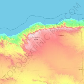
Name: Sanaag topographic map, elevation, terrain.
Location: Sanaag, Somalia (9.42000 46.01003 11.52611 49.06000)
Average elevation: 621 m
Minimum elevation: 0 m
Maximum elevation: 2,392 m
Other topographic maps
Click on a map to view its topography, its elevation and its terrain.