
富士川町 topographic map
Interactive map
Click on the map to display elevation.
About this map
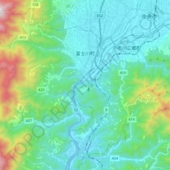
Name: 富士川町 topographic map, elevation, terrain.
Location: 富士川町, 南巨摩郡, 山梨县, 中部地方, 日本 (35.47833 138.32100 35.59503 138.47903)
Average elevation: 536 m
Minimum elevation: 217 m
Maximum elevation: 1,824 m
Other topographic maps
Click on a map to view its topography, its elevation and its terrain.