Geolocate

Obourg topographic map

Click on the map to display elevation.

About this map
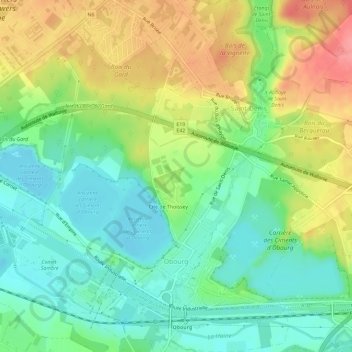
Name: Obourg topographic map, elevation, terrain.

Location: Obourg, Mons, Hainaut, Wallonia, 7034, Belgium (50.46653 3.97970 50.50330 4.02955)

Average elevation: 61 m

Minimum elevation: 28 m

Maximum elevation: 110 m

Other topographic maps

Click on a map to view its topography, its elevation and its terrain.
Warchaix

Belgium > Hainaut > Mons > Mons > Harveng

Average elevation: 64 m

La Masure

Belgium > Hainaut > Mons > Mons

Average elevation: 46 m

Gear up for your next adventure:

🧢Hiking Hats & Caps - Protective headwear for sun and rain
🧤Touchscreen Glove Liners - Use your mapping app without freezing your hands
🛡️Protective Bike Gear - Helmets & pads for safe rides
💺Camping Hammocks - Relax afloat camp setup
🍽️Camping Utensil Sets - Complete eating sets

As an Amazon Associate, this site earns from qualifying purchases at no extra cost to you.