
Gemeinde Pfaffenhofen topographic map
Interactive map
Click on the map to display elevation.
About this map
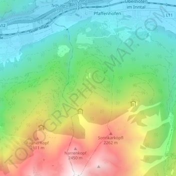
Name: Gemeinde Pfaffenhofen topographic map, elevation, terrain.
Average elevation: 1,324 m
Minimum elevation: 612 m
Maximum elevation: 2,776 m
Other topographic maps
Click on a map to view its topography, its elevation and its terrain.
Gemeinde Seefeld in Tirol
Austria > Tyrol > Bezirk Innsbruck-Land
Gemeinde Seefeld in Tirol, Bezirk Innsbruck-Land, Tyrol, 6100, Austria
Average elevation: 1,303 m