Geolocate

Conway County topographic map

Interactive map

Click on the map to display elevation.

About this map

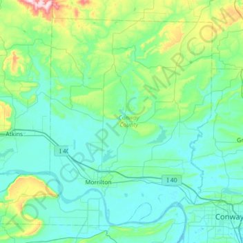
Name: Conway County topographic map, elevation, terrain.

Location: Conway County, Arkansas, United States of America (35.07143 -93.04082 35.46360 -92.47947)

Average elevation: 155 m

Minimum elevation: 78 m

Maximum elevation: 615 m

Other topographic maps

Click on a map to view its topography, its elevation and its terrain.

Cleburne County

United States of America > Arkansas

Cleburne County, Arkansas, United States of America

Average elevation: 223 m

Mount Ida

United States of America > Arkansas > Mount Ida

Mount Ida, Montgomery County, Arkansas, United States of America

Average elevation: 215 m

Cross County

United States of America > Arkansas

Cross County, Arkansas, United States of America

Average elevation: 73 m