
Province of Ica topographic map
Interactive map
Click on the map to display elevation.
About this map
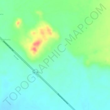
Name: Province of Ica topographic map, elevation, terrain.
Location: Province of Ica, Peru (-14.33866 -75.64838 -14.33856 -75.64828)
Average elevation: 341 m
Minimum elevation: 320 m
Maximum elevation: 384 m
Other topographic maps
Click on a map to view its topography, its elevation and its terrain.
Province of Asunción
The province consists sloping land that are part of the Andean flanks delimiting with other provinces and are of rugged topography, the soils are moderately deep to shallow, medium to low fertility, with both coarse fragments in the profile and on the surface thereof, are highly erodible. The normal topography…
Average elevation: 4,264 m
Arequipa
This department has a rough topography, which is characterised by heavy layers of volcanic lava covering large areas of its inter-Andean sector. It has deep canyons such as the ones formed by the Ocoña and Majes rivers. Plateaus range in height from medium, such as La Joya, and high-altitude ones such the…
Average elevation: 2,599 m
Junín
The region has a very heterogeneous topography. The western range located near the border with the Lima Region, has snowy and ice-covered peaks. On the east, there are high glacier valleys which end up in high plateaus (Altiplano). Among them is the Junín Plateau that is located between the cities of La Oroya…
Average elevation: 2,657 m
Piura
Topography is smooth in the coast and rough in the Sierra. There are many arid plains in the southern region. The Sechura Desert, located south of the Piura River, is Peru's largest desert and one of the world's few examples of a tropical desert; it borders a tropical terrain to the north. The Bayóvar…
Average elevation: 675 m
Ica
Ica has significant wine and pisco industries, annual fiestas, a museum and historic colonial churches. The climate is generally sunny and dry due to its elevation above coastal fog and mist. As of 2020, the Peruvian desert, around the Huacachina Oasis, has gotten significantly popular among tourists for…
Average elevation: 1,624 m