Geolocate

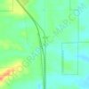
Douglas topographic map

Click on the map to display elevation.

About this map

Name: Douglas topographic map, elevation, terrain.

Location: Douglas, Converse County, Wyoming, 82633, United States (42.73272 -105.44574 42.77789 -105.34510)

Average elevation: 1,492 m

Minimum elevation: 1,453 m

Maximum elevation: 1,559 m

Other topographic maps

Click on a map to view its topography, its elevation and its terrain.
Shawnee

United States > Wyoming > Converse County

Average elevation: 1,542 m

Bill

United States > Wyoming > Converse County

Average elevation: 1,434 m

Gear up for your next adventure:

💡Hiking Headlamps - Hands‑free lights for night hikes
🚶‍♂️Trekking Poles - Supportive poles for stability on varied terrain
📦Outdoor Storage Bags - Keep gear organized and dry
🧂Electrolyte Tablets - Stay hydrated during strenuous mountain climbs
🔦LED Flashlights - Bright, durable flashlights for outdoor use

As an Amazon Associate, this site earns from qualifying purchases at no extra cost to you.