Geolocate

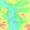
Shawnee topographic map

Click on the map to display elevation.

About this map

Name: Shawnee topographic map, elevation, terrain.

Location: Shawnee, Converse County, Wyoming, United States (42.72775 -105.02969 42.76775 -104.98969)

Average elevation: 1,542 m

Minimum elevation: 1,495 m

Maximum elevation: 1,622 m

Other topographic maps

Click on a map to view its topography, its elevation and its terrain.

Glenrock

United States > Wyoming > Converse County

Average elevation: 1,546 m

Douglas

United States > Wyoming > Converse County

Average elevation: 1,492 m

Douglas

United States > Wyoming > Converse County

Average elevation: 1,492 m

Gear up for your next adventure:

☕Vacuum Insulated Flasks - Keep tea or coffee hot for 12 hours on the summit
🖊️All-Weather Pens - Pressurized ink cartridges that write upside down and in wet
🧦Merino Wool Socks - Moisture-wicking and blister-preventing trail socks
🧯Camp Safety Kits - All‑in‑one safety gear
🥾Mountaineering Boots - Heavy‑duty boots for rugged peaks

As an Amazon Associate, this site earns from qualifying purchases at no extra cost to you.