Geolocate

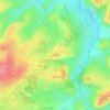
Val-Fouzon topographic map

Click on the map to display elevation.

About this map

Name: Val-Fouzon topographic map, elevation, terrain.

Location: Val-Fouzon, Issoudun, Indre, Centre-Val de Loire, Metropolitan France, 36210, France (47.16891 1.54800 47.24407 1.70179)

Average elevation: 105 m

Minimum elevation: 72 m

Maximum elevation: 148 m

Other topographic maps

Click on a map to view its topography, its elevation and its terrain.

Le Fragne

France > Centre-Val de Loire > Indre > Sarzay

Average elevation: 224 m

Fein

France > Centre-Val de Loire > Indre > Nohant-Vic

Average elevation: 198 m

Larage

France > Centre-Val de Loire > Indre > Migné > Chézal Fragné

Average elevation: 119 m

Grandchamp

France > Centre-Val de Loire > Indre > Pérassay

Average elevation: 334 m

Nuissance

France > Centre-Val de Loire > Indre > Levroux

Average elevation: 161 m

Nuissance

France > Centre-Val de Loire > Indre > Levroux

Average elevation: 161 m

L'Amoureux

France > Centre-Val de Loire > Indre > Champillet

Average elevation: 276 m

Les Arènes

France > Centre-Val de Loire > Indre > Levroux

Average elevation: 151 m

Avail

France > Centre-Val de Loire > Indre > Issoudun

Average elevation: 153 m

Éguzon

France > Centre-Val de Loire > Indre > Éguzon-Chantôme

Average elevation: 255 m

Les Marigouts

France > Centre-Val de Loire > Indre > Clion

Average elevation: 137 m

Charneuil

France > Centre-Val de Loire > Indre > Mauvières

Average elevation: 115 m

Gear up for your next adventure:

🍴Camp Kitchen Kits - Lightweight nesting pots and pans for backpacking
🦯Lightweight Trekking Poles - Reduce knee strain on steep Wicklow or Kerry slopes
👖Zip-off Hiking Pants - Adapt to changing Irish temperatures quickly
🧿Outdoor Gadgets - Innovative tools for outdoor enthusiasts
🪶Down Jackets - Warm jackets for cold outdoor trips

As an Amazon Associate, this site earns from qualifying purchases at no extra cost to you.