
Crucita topographic map
Interactive map
Click on the map to display elevation.
About this map
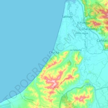
Name: Crucita topographic map, elevation, terrain.
Location: Crucita, Portoviejo, Manabí, Equador (-0.95089 -80.58694 -0.79614 -80.49061)
Average elevation: 38 m
Minimum elevation: -1 m
Maximum elevation: 285 m
Other topographic maps
Click on a map to view its topography, its elevation and its terrain.