
Portoviejo topographic map
Interactive map
Click on the map to display elevation.
About this map
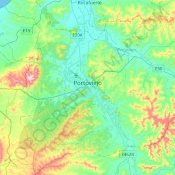
Name: Portoviejo topographic map, elevation, terrain.
Location: Portoviejo, Manabí, Equador (-1.20299 -80.56250 -0.92071 -80.31676)
Average elevation: 166 m
Minimum elevation: 0 m
Maximum elevation: 640 m
Other topographic maps
Click on a map to view its topography, its elevation and its terrain.